Thursday, August 30, 2012

Experimental Breeder Reactor 1

As I left Craters of the Moon, I came across signs for Experimental Breeder Reactor 1.  This is the reactor that generated power for the town of Arco.  It is open to the public.

An informational sign with the history of the place.  I took a number of photos, but since they're pictures of control panels and I don't recall what most of them are, I'm only posting a few pictures from the place.


After generating power, the people working on the reactor signed the wall.  It has been encased in wood and glass, or plex, to preserve it.


A plaque honoring the contributions to the women who worked at the site.


The reactor was housed here.  This is part of the containment vessel.


The government was looking into a nuclear powered bomber.  This is a nuclear reactor designed horizontally for that plane.


A train engine designed to move the nuclear powered bomber into and out of the hanger.  It is lined with lead to shield it from radiation.


The Snake River Plateau near EBR-1.


Big South Butte near EBR-1.  You can see the facility on the right.


Big South Butte.

Sunday, August 26, 2012

Craters of the Moon National Monument - Moonset

My plan for the evening was to get some shots of the night skies.  I drove to Inferno Cone and climbed to the top.  I hadn't tried any shots of the moon or really low light shots and thought it would be a good place to give it a shot.  The view was amazing.


Big South Butte 25 miles away.


The top of Inferno Cone.


The top of Inferno Cone. The light green mound is called a kipuka. There are a couple in the Park.  They're sticking out above the lava flows and apparently have their own ecosystems, having been isolated from the surrounding from the surrounding area by the lava flows.


Being on the top of the cone was an interesting experience.  Normally sunset is just one of those things you don't notice, even if you're outside.  As the sun set, I noticed it getting noticeably darker.  It was almost like someone was using a dimmer switch and turning down the light.


I didn't have any previous experience trying this setup shooting the moon.  I think the pictures turned out okay, but I think I'd also like a bit larger lens.


I spent several hours up there as the sun set, returning to my car only after dark.  I was hoping to get the moon setting over the mountains, but there wasn't enough light for my lens and I wasn't familiar enough with my camera to get anything better.  Still, I'm pretty pleased with the image.

Craters of the Moon National Monument - Part 2

After the unguided walk I drove around the park, then caught up with a guided tour.  It was very informative and well worth the time.

A pressure ridge formed in the lava.


Looking back the way we'd come through the lava.


Looking over the lava fields.


An unusual sight here in Craters of the Moon.  A fern that has managed to in the micro-climate of the crack in the lava.  It receives enough water and shade to grow in the middle of the desolation.


A cave in the lava fields.  It is home to bats and pigeons.  The pigeons are an invasive species and are forcing out the native bird.  Bbecause of laws governing the Park System they are not allowed to be killed.  They put owl statues up to scare them off, but that apparently only lasted a few days.


My campsite.  It was in a depression and I chose it because it would be out of the sun before the surrounding area.  No open fires were allowed.  This was the first day I experienced the incredibly high heat that we've experienced this summer.  It was 105 during the day, but cooled down significantly at night.  It was also dry.  The humidity recorded at the visitors center was less than 12 percent.  When I drained the cooler the water running down the slope created a dust cloud ahead it.  I'd never seen anything like that.

Saturday, August 25, 2012

Craters of the Moon National Monument - Part 1

I arrived at Craters of the Moon National Monument early the next morning, a Sunday, after having slept in my car at a rest area.  Craters of the Moon is about 15 miles southwest of Arco, Idaho and would be the furthest west I would make it on this trip.

In what was really the only time I missed something,  I arrived about 7 in the morning to find the campground full.  Looking around, I saw that there had been a Star Party the previous two nights.  I don't regret the time I spent at Two Medicine, but I think if I'd known this was going on, I'd have left earlier or pushed on the night before.  By 9am, the campground was nearly empty.


The sun rising over Craters of the Moon National Monument.  The vertical shadow on the left is from the sign announcing you're entering the park.


Sunrise.


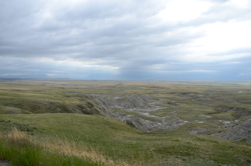
This is from the first proper turnout and is not far from the actual park entrance.


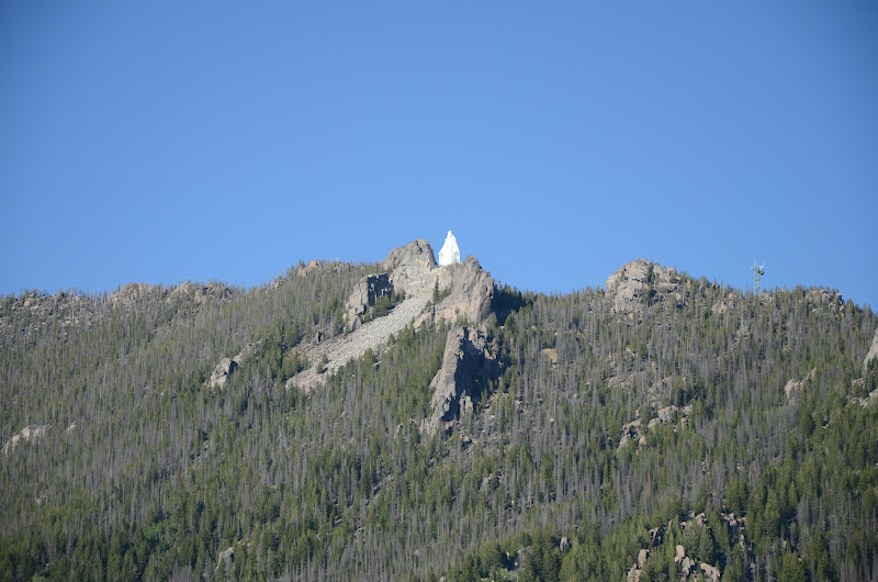
One of the peaks.  This is an old volcano if I recall correctly.


A short nature walk behind the campground.


Even here in the middle of volcanic rock and scrub plants, there were flowers.


Along the hiking trail.


This tree had a disease called Witch's Broom.  Thousands of trees were destroyed in the past because they were deemed unsightly.  As conservation methods and the National Parks mission has evolved, these trees are no longer cut down.  This particular tree was dead, but it had died of natural causes.


A closeup of the broom.

Wednesday, August 22, 2012

Arco, Idaho

Early the next morning I was passing through Arco, Idaho about 15 miles from Craters of the Moon.  Arco has the distinction of being the first city in the world to receive it's electricity from a nuclear power plant.  Experimental Breeder Reactor One (EBR1) is located east of the city and in 1955 it began providing power to the town of Arco. 


As I was passing through town, the green and orange shape above caught my eye.  I immediately recognized it as a torpedo and turned around to see why there was a torpedo displayed in a tiny city in the middle of Idaho.

This was part of a display at the Idaho Science Center.  It is all outside and primarily focused on the submarines and the role of nuclear power in warfare.  The two granite stones are monuments to submariners and there is some basic information on the torpedo.


This is the sail from the U.S.S. Hawkbill, a nuclear powered attack submarine that was decommissioned in 2000.  The sail was stripped of it's classified materials and shipped to Arco to be put on display.

Tuesday, August 21, 2012

Between Glacier and Craters of the Moon

After leaving Glacier, I headed south.  The weather soon began to clear.

Looking west from along the roadside.


From the same vantage point.


The sun peeking through the clouds.


Driving along, I saw this bridge that appeared to be abandoned.  I've always been fascinated with structures like this, wondering why they were abandoned.  As I've gotten older, I've come to understand this more, but I still see them as windows to a time past and stories forgotten.


Clouds forming as the air rises over the mountain.


Looking back the way I came.


As I approached Butte, I saw this statue.  Named Our Lady of the Rockies, it is a statue of the Virgin Mary and was erected on the Continental Divide by the people of Butte.  At 90 feet tall, it is the second tallest statue in the States second only to the Statue of Liberty.  It is dedicated to women everywhere, in particular mothers.

Running Eagle Falls

After I left the Many Glacier area, my destination was Craters of the Moon National Monument.  On the spur of the moment, I decided to stop by the southern portion of Glacier National Park.  This area is called Two Medicine and was the most popular part of the park until the completion of Going to the Sun Road.

I wasn't able to see the great vistas, and I wanted to get to Craters of the Moon, so I sort of limited my time there.  Still, I was able to get take a short hike to Running Eagle Falls.  This area, and these falls in particular, hold a spiritual significance for the Blackfeet. 


Running Eagle Falls is also called Trick Falls.  The falls consist of two parts.  When water flow is high, water flows from the top of the falls as seen here.  It also flows through a cave that comes out about a third of the way up the falls.  When water flow declines, water no longer flows over the top and comes from the cave only.  I was here in June and snow melt was still feeding the rivers.  In addition, it was raining lightly. 


To get closer to the falls, there is a small bridge crossing this river which was flowing at a rapid pace.  This is looking upriver from the bridge.


This is looking downriver from the bridge to where the river joins with the river from the falls.  The long sandbar in the center of  picture is the same one in the first picture.  The first picture was taken downstream and to the left of the tree on the left.


Closer to the falls.  Here you can see both the upper and lower portions of the falls.

Friday, August 10, 2012

Wildflowers in the Many Glacier area

After leaving Waterton, I was much more aware of wildflowers along the road.  The next day as I was leaving the Many Glacier area, I saw these.  Again, I don't know what they are, I just thought they were pretty.

A pair of pink flowers.


The lone red flower I saw.


Purple and Pink.


Looking over Lake Sherburne.

Thursday, August 9, 2012

Waterton Wildflower Festival

I stopped at a scenic overlook to take some pictures.  While there, I started talking to a guy who pulled in next to me.  A moment later a woman stopped and we all started talking.  Waterton was having a wildflower festival that week.  Apparently, Waterton has the largest number of wildflower species in Alberta, and maybe Canada.  I don't recall.  It is a huge event and draws people from all over. 

The woman worked in the park and the guy had driven down from Calgary and was one of the guides taking people out to see the wild flowers.  We drove back down the road and he started pointing out flowers.


These are Lady Slippers.  He said you're usually lucky to see one of them, but they were all over the place.  These are the only flowers I remember the name of.   They are a type of orchid.


Here is one of the plants.  There were bunches of these plants lining the road.


A lone flower.


A red flower.


I thought these were very pretty.


 Again, I don't know what these were.


 This may be Butterwort.  I know he pointed out some, saying it was the first and only time he'd see anything other than a white flower.


Looking into Waterton Lakes National Park.