Showing posts with label Lighthouses. Show all posts

Tuesday, October 8, 2013

Put-in-Bay

I'm actually trying to get caught up on things. On Labor Day I headed down to Put-in-Bay. The impetus for this trip was the reenactment of the Battle of Lake Erie. This was a pivotal battle in the War of 1812 and there were going to be tall ships from all over there to participate in the reenactment. To be quite honest, the trip was a big disappointment. Both Ken and I had big plans for the day, but the weather was iffy and our lack of familiarity the area meant we didn't really know where to go for the best shots. We managed to get some, but they were less than ideal.


This was the ferry we took over. Miller Ferry was nice and the ride wasn't too bad. I thought they dropped us off downtown, but I was wrong. It dropped us off on the other side of the island a mile or
so from there.


On the way over, the sun broke through the overcast long enough to get this picture.


Once we got downtown there were a number of tall ships moored and sailing in the bay.


 If I recall, this ship was giving cruises around the bay.


Flags outside the Peace Memorial.  They are all the same height to show the lasting peace between the three nations.


Leaving port with a load of tourists.


One of the larger ships coming into port.


Another shot.  I don't recall which ship this is.


Another ship coming into port.


The Perry International Peace Memorial.  It was built to honor those who died in the Battle of Lake Erie.  There is an elevator to the top and the view is quite amazing.


This guy was dressed in period uniform outside the Perry International Peace Memorial.


A view from the top of the Perry International Peace Memorial.


This is the top of the Perry International Peace Memorial.


This is one of the few pictures I took of the reenactment.  It was several miles out in the lake and not much could be seen.


This is a home on South Bass Island that is made from the pilothouse of the Benson Ford.  It is a vacation home overlooking Lake Erie.


This is the South Bass Island lighthouse.  The property is owned by Ohio State University.

Friday, August 9, 2013

Point Iroquois Lighthouse

I got to the Point Iroquois Lighthouse early in the morning. When I got there the sun was hitting the building in just the right way to give it a soft glow. The keeper who lives there came out and told me he was going to open the light up for me. In the minute or so that I talked to him the sun moved behind the clouds and did not reappear while I was there. So some advice to those who have have the right light is to take the picture then and do other things after you get the picture.


Point Iroquois is named because of the massacre of Iroquois by the Ojibwa in 1662.  The Iroquois were expanding west and the Ojibwa were not pleased and were determined to drive the Iroquois out of the area.


The view from the top of the lighthouse looking west.  The light and keeper station were restored in 1993.  A keeper stays there all year because vandalism was a problem. 


The lighthouse was built in 1855 and 1856.  It was replaced by the current structure in 1872.  It operated until 1962 when it was deactivated and replaced with the Gros Cap light that sits in the channel. 

The site is on the National Register of Historical Places.  Because of this, there are limits to what can and cannot be done on the site and for renovation. 

For example, the building was painted recently.  The paint had to be approved by Washington.  Unfortunately, the paint that was approved is already peeling off the tower because while the rest of the structure is heated, the tower is not.   Now they have to wait for approval to fix the peeling paint, and can only do so with an approved of material.

There is a nice boardwalk in the area from which the second image is shot from.  It took several years for the government to approve the boardwalk.  It runs down to the beach and is well worth the short walk.

Sunday, June 23, 2013

Grand Haven

A friend of mine is involved in French-Indian War reenacting. He told me of an event they were going to be attending in Grand Haven so I grabbed Ken and we headed out.


This was the twelfth Feast of the Strawberry Moon.  Eighteenth century reenactors gather and create a living experience.  This guy was a trader.  He worked for the historical society in Lansing, I think, and was very knowledgeable about the period and the trade.


One of the big events is a battle between French and American forces.  Here the French fire on American troops.


Another volley as the French advance across the field.


Taking aim.


FIRE!

Unfortunately, most of the pictures turned out poorly.  It was a valuable learning experience and next time I think I'll end up with better images.


This was a small Indian village.  Fish were being smoked over the fire.


A blacksmith plies his trade.


Afterwards, we headed out to the lighthouse.  On the way we passed this old Pere Marequette engine.  It looks like it is open at times, but wasn't at when we were there.


The Grand Haven lighthouse.


I wish I had shot this just a little lower so I wouldn't have cut off the woman's feet.


The reminds me of the bow of a great ship.

Sunday, June 16, 2013

Port Huron Boatnerd Gathering

June 1st saw a gathering of boatnerds in Port Huron.  Since this has been covered by those there and boats are not the focus of my blog I will only post a few pictures.


While we were there the brig Niagara headed down the river.  She will be moored at South Bass Island over the 4th of July to celebrate the anniversary of Admiral Perry's victory over the British in the War of 1812.


The CSL Tadoussac and the Frontenac were moored across the river.  They are in temporary layup.


You can see they're sitting pretty high in the water.  Here you can see the bow thruster which is is used to help the ship maneuver.


While taking the Huron Lady II on a brief cruise we encountered the Michipicoten downbound as she approached the Saint Clair River.


The Michipicoten as a squall passes behind her on Lake Huron.


The Michipicoten approaches.


Stormy Seas.


The Michipicoten enters the Saint Clair River.

Thursday, February 21, 2013

Whitefish Point in Winter

After leaving Tahquamenon Falls, we decided to head up to Whitefish Point since we were in the area.  I'd never been there in the winter either so figured it would be a nice photo op.  I was really surprised at how well plowed the road was all the way out to the point.   It was really nice.

As we pulled up, it was clear there was nobody around.  Looking toward the lake from the parking lot it seemed like the snow was drifted pretty high, and it was, but it wasn't as imposing as it first appeared once we got out of the car.


Lake Superior was frozen.  I wasn't really surprised by that as I've heard and seen pictures of ice along the shore.  These old pier pilings are usually in the water.


Here, you can see the frozen lake.  The mounds of ice are caused by pressure under and on the ice.  I walked out to the ridge you see on the horizon.


As I got close, I started moving pretty slowly.  This is what awaited me.  This drop off was fifteen feet or so.  Maybe more.  The ice below looked very thin, though compared to what I was walking on, a foot of ice would have seemed thin.  I wasn't concerned about walking out to the ridge.  Once I got there, got a bit more nervous.  More for fear of  slipping and falling over the edge than anything else.  The dark area on the horizon is open water.


Looking to the left from where I was standing.  What you can't see, and what this picture can't convey is just how hard the wind was blowing and just how cold it felt.  To say I was cold is an understatement.  The wind was piercing even with my scarf wrapped around my head, it wasn't enough.


Looking back at the lighthouse as I returned. 

This picture was taken from the seat of my car.  I could have positioned myself better, but by the time I got back, all I wanted to do was crank up the heat.  I rolled down the window, took the picture and rolled it back up again. You can see they boarded up a number of the buildings for the winter.

If you get a chance, stop by anytime of year.  It really is a beautiful place.

Sunday, December 23, 2012

Cleveland


We stopped in Cleveland as it was getting dark.  Ken wanted to see an old Coast Guard Station.  I saw this lift bridge and guessed it no longer functioned.  A couple of minutes later a train passed by.


The Coast Guard Station we were there to see.  Unfortunately, it seems it sustained some damage from Hurricane Sandy.  The walkway was fenced off and the causeway was closed.


As a train crossed the bridge, I noticed this tug sitting on the river behind the bridge.  It was getting pretty dark so the exposure time was a little longer than I wanted.


And as if to prove that it did indeed work, the bridge begins to raise to allow the tug out onto Lake Erie.
Posted by Picasa

Saturday, December 22, 2012

Marblehead

Our first real stop once we finally got underway was Marblehead. He'd told me about this before, but I'd never been there and he thought I'd like it. I'm glad we stopped, but unfortunately this diversion along with the trip to Detroit meant that what was supposed to be the focus of the trip got no more than cursory coverage.
 
The Marblehead Light and Keeper's house.  Here you can see one of the problems shooting with a wide angle lens.  The fish-eye looks is starting to appear.  It is particularly noticable with the overly slanted lighthouse.
 
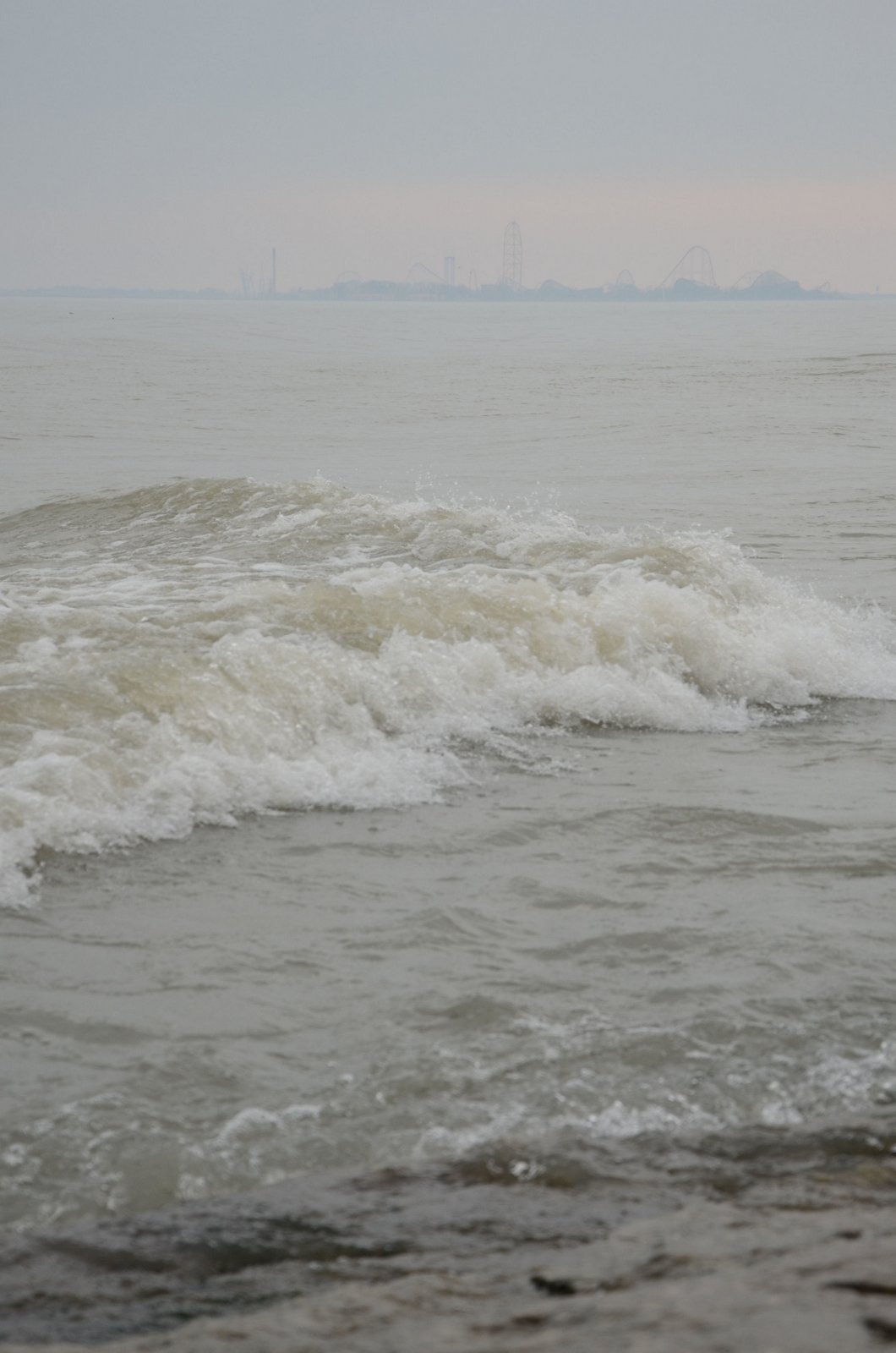
Cedar Point as seen from Marblehead.

 
Another view of the light.  It appears prettly slanted in this image as well.
 
Cedar Point again.
 
And again.  I'm going to have to come back here sometime in the evening when the park is open.  I'd love to get it all lit up.
Posted by Picasa