Last week I decided to head to The Headlands. Since I got there several hours before dark I spent the time in Mackinaw City, and by extension, the Bridge.
I missed one ship, but managed to get there in time to capture this one.
Approaching the bridge.
I like the way the arch of the shadow falls across the boat almost like an extension of the bridge.
Unfortunately, there are a number of problems with these images and rather than no post them or correct them I thought I'd put them up as an example of what not to do. Or rather, what to look for.
One of the issues with digital camera is dust. If you look at these images, you can see the dark, slightly grey-black spots in the sky. This is a result of dust. No matter how hard you try, you're going to end up with dust in your images at some point if you switch lenses.
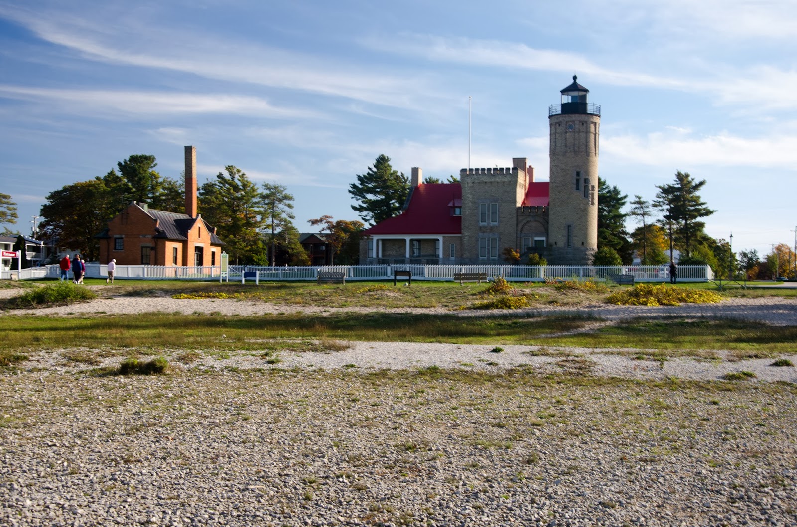
The Mackinaw City Lighthouse.
Mackinac Island and the passing ship.
I returned after dark and took this picture. Again, there are a number of issues with it, but as I am still learning more about night photography, I am satisfied with it.
Wednesday, October 23, 2013
Saturday, October 19, 2013
Point Pelee
Awhile back I went to Point Pelee and apparently forgot to post pictures from the trip.
So here they are.
Point Pelee is the southernmost point in Canada with the exception Pelee Island and Middle Island which are in Lake Erie. It is a spit of land that extends a little over 4 miles into Lake Erie. It is the smallest of Canada's National Parks encompassing 5.8 square miles. Originally it was established to protect the timber as a supply for naval ships.
The Park is pretty varied. The point itself is sand, but there is a large wetland area. There is a boardwalk cutting through the area and the walk is very nice. Because of the habitat and it's position extending into the lake, Point Pelee draws birdwatchers from all over.
In addition to birdwatchers, Point Pelee also serves as a place where Monarch butterflies stop on their migration route either before crossing the lake or after crossing it when moving north. You can rent canoes and head out into the wetland. The trees on the horizon represent a barrier to Lake Erie I believe.
Standing at the point you can see shipping. This is the Wagenborg heading west. I believe that Pelee Island is in the background.
This is the actual point. There were a couple of times where you could see land a bit further out, but it was covered by water almost all the time. Even this was pretty much covered and it drained really quickly. The point shifts over time and can change shape as a result of wind and wave action.
No, I didn't accidentally post a picture from my (nonexistent) trip to a tropical paradise. This is looking north from roughly the same point the last picture was taken. There is no swimming out on the point. There can be really strong rip currents along the point. There are warnings as well as a memorial to a boy who drowned after being pulled out into the lake..
Some more of the waves coming in from the west.
Looking north again.
One thing I didn't expect to see was this. Prickly Pear cactus. Although normally associated with the desert, hese are native to the area. They like the sandy soil and the moderate temperatures.
With the lake on both sides of the land mass and distance south, the temperature is pretty well moderated. This made it ideal for people to farm and for quite some time there was a community here that did just that.
The land was eventually turned into a park and the people living there had to move. This is one of the remaining homes.
Although efforts are underway to restore the area to it's natural state, canals like this that were dug for irrigation remain.
I want to go back again one of these days. It was a great place to visit.
So here they are.
Point Pelee is the southernmost point in Canada with the exception Pelee Island and Middle Island which are in Lake Erie. It is a spit of land that extends a little over 4 miles into Lake Erie. It is the smallest of Canada's National Parks encompassing 5.8 square miles. Originally it was established to protect the timber as a supply for naval ships.
The Park is pretty varied. The point itself is sand, but there is a large wetland area. There is a boardwalk cutting through the area and the walk is very nice. Because of the habitat and it's position extending into the lake, Point Pelee draws birdwatchers from all over.
In addition to birdwatchers, Point Pelee also serves as a place where Monarch butterflies stop on their migration route either before crossing the lake or after crossing it when moving north. You can rent canoes and head out into the wetland. The trees on the horizon represent a barrier to Lake Erie I believe.
Standing at the point you can see shipping. This is the Wagenborg heading west. I believe that Pelee Island is in the background.
This is the actual point. There were a couple of times where you could see land a bit further out, but it was covered by water almost all the time. Even this was pretty much covered and it drained really quickly. The point shifts over time and can change shape as a result of wind and wave action.
No, I didn't accidentally post a picture from my (nonexistent) trip to a tropical paradise. This is looking north from roughly the same point the last picture was taken. There is no swimming out on the point. There can be really strong rip currents along the point. There are warnings as well as a memorial to a boy who drowned after being pulled out into the lake..
Some more of the waves coming in from the west.
Looking north again.
One thing I didn't expect to see was this. Prickly Pear cactus. Although normally associated with the desert, hese are native to the area. They like the sandy soil and the moderate temperatures.
With the lake on both sides of the land mass and distance south, the temperature is pretty well moderated. This made it ideal for people to farm and for quite some time there was a community here that did just that.
The land was eventually turned into a park and the people living there had to move. This is one of the remaining homes.
Although efforts are underway to restore the area to it's natural state, canals like this that were dug for irrigation remain.
I want to go back again one of these days. It was a great place to visit.
Sunday, October 13, 2013
Richmond Field
It has been awhile since I've flown or even visited the field where I flew sailplanes. I decided a couple of weeks back to drive out and see what was happening.
After clearing it with the people in charge, I drove down to the far end of the runway and pulled off to get some pics. While I was down there I figured I'd get a pic of both of my favorite things.
Richmond Field is located about 2 miles southeast of Gregory, Michigan. The grass runway is 2471 feet long and 100 feet wide and has an elevation of 921 feet.
It is privately owned by SEMSA (South East Michigan Soaring Association) who in turn leases it to Sandhill Soaring Club who uses it for soaring activities.
Here, the club Piper Pawnee tows the Schleicher K13 into the air.
Most take offs are from north to south if the wind isn't too strong as there are more options in case of a rope break or power failure.
In the background you can see the windsock and hangars.
Climbing out.
A view of the K13 as she passes overhead.
Off into the grey, overcast day. Ultimately, it cleared up nicely and I suspect it was a great day for soaring.
Of course, I had to take a couple of pictures of my car. Here I was messing around with the polarizing filter.
From where I was standing, I could either darken the windshield or the side of the car, but not both.
While waiting for the glider to return this plane did a flyby.
The Pawnee comes in to land.
Followed a while later by the K13.
Moments from touchdown.
After clearing it with the people in charge, I drove down to the far end of the runway and pulled off to get some pics. While I was down there I figured I'd get a pic of both of my favorite things.
Richmond Field is located about 2 miles southeast of Gregory, Michigan. The grass runway is 2471 feet long and 100 feet wide and has an elevation of 921 feet.
It is privately owned by SEMSA (South East Michigan Soaring Association) who in turn leases it to Sandhill Soaring Club who uses it for soaring activities.
Here, the club Piper Pawnee tows the Schleicher K13 into the air.
Most take offs are from north to south if the wind isn't too strong as there are more options in case of a rope break or power failure.
In the background you can see the windsock and hangars.
Climbing out.
A view of the K13 as she passes overhead.
Off into the grey, overcast day. Ultimately, it cleared up nicely and I suspect it was a great day for soaring.
Of course, I had to take a couple of pictures of my car. Here I was messing around with the polarizing filter.
From where I was standing, I could either darken the windshield or the side of the car, but not both.
While waiting for the glider to return this plane did a flyby.
The Pawnee comes in to land.
Followed a while later by the K13.
Moments from touchdown.
Labels:
Piper Pawnee,
Richmond Field,
Sandhill Soaring,
Schleicher K13
Tuesday, October 8, 2013
Marsh View Meadows
While at Lillie Park I was talking to one of the employees who maintains the park and he suggested Marsh View Meadows park on Textile. The park seems to encompass both sides of Textile road with a parking
area north on Marton Road. When I walked through there there was a lot
of tall grass. As in over my head tall.
I wandered over there a couple of days later but again it was getting late and the light was poor for the location I was shooting from. This is from the park area near the railroad tracks.
Purple Loosestrife. Although pretty, it is still an invasive species.
I wandered over there a couple of days later but again it was getting late and the light was poor for the location I was shooting from. This is from the park area near the railroad tracks.
Purple Loosestrife. Although pretty, it is still an invasive species.
Lille Park
Lillie Park is on the corner of Platt and Elsworth and is a fairly sizable park for it's location. There are really a couple of entrances, one right near the corner and another to the south a bit. If you live in the Ann Arbor area, do yourself a favor and visit the park.
To the south there are a number of trails. At the center is a large pond. The boardwalk which had been closed and underwater for the past couple of years has opened back up.
Looking to the southwest from the northern part of the boardwalk.
Essentially the same shot. The light was getting low and I started watching a sky writer that was scrawling a message across the sky.
To the south there are a number of trails. At the center is a large pond. The boardwalk which had been closed and underwater for the past couple of years has opened back up.
Looking to the southwest from the northern part of the boardwalk.
Essentially the same shot. The light was getting low and I started watching a sky writer that was scrawling a message across the sky.
Put-in-Bay
I'm actually trying to get caught up on things.
On Labor Day I headed down to Put-in-Bay. The impetus for this trip was the reenactment of the Battle of Lake Erie. This was a pivotal battle in the War of 1812 and there were going to be tall ships from all over there to participate in the reenactment.
To be quite honest, the trip was a big disappointment. Both Ken and I had big plans for the day, but the weather was iffy and our lack of familiarity the area meant we didn't really know where to go for the best shots. We managed to get some, but they were less than ideal.
This was the ferry we took over. Miller Ferry was nice and the ride wasn't too bad. I thought they dropped us off downtown, but I was wrong. It dropped us off on the other side of the island a mile or
so from there.
On the way over, the sun broke through the overcast long enough to get this picture.
Once we got downtown there were a number of tall ships moored and sailing in the bay.
If I recall, this ship was giving cruises around the bay.
Flags outside the Peace Memorial. They are all the same height to show the lasting peace between the three nations.
Leaving port with a load of tourists.
One of the larger ships coming into port.
Another shot. I don't recall which ship this is.
Another ship coming into port.
The Perry International Peace Memorial. It was built to honor those who died in the Battle of Lake Erie. There is an elevator to the top and the view is quite amazing.
This guy was dressed in period uniform outside the Perry International Peace Memorial.
A view from the top of the Perry International Peace Memorial.
This is the top of the Perry International Peace Memorial.
This is one of the few pictures I took of the reenactment. It was several miles out in the lake and not much could be seen.
This is a home on South Bass Island that is made from the pilothouse of the Benson Ford. It is a vacation home overlooking Lake Erie.
This is the South Bass Island lighthouse. The property is owned by Ohio State University.
This was the ferry we took over. Miller Ferry was nice and the ride wasn't too bad. I thought they dropped us off downtown, but I was wrong. It dropped us off on the other side of the island a mile or
so from there.
On the way over, the sun broke through the overcast long enough to get this picture.
Once we got downtown there were a number of tall ships moored and sailing in the bay.
If I recall, this ship was giving cruises around the bay.
Flags outside the Peace Memorial. They are all the same height to show the lasting peace between the three nations.
Leaving port with a load of tourists.
One of the larger ships coming into port.
Another shot. I don't recall which ship this is.
Another ship coming into port.
The Perry International Peace Memorial. It was built to honor those who died in the Battle of Lake Erie. There is an elevator to the top and the view is quite amazing.
This guy was dressed in period uniform outside the Perry International Peace Memorial.
A view from the top of the Perry International Peace Memorial.
This is the top of the Perry International Peace Memorial.
This is one of the few pictures I took of the reenactment. It was several miles out in the lake and not much could be seen.
This is a home on South Bass Island that is made from the pilothouse of the Benson Ford. It is a vacation home overlooking Lake Erie.
This is the South Bass Island lighthouse. The property is owned by Ohio State University.
Monday, October 7, 2013
Wyandotte
One evening after work I saw this train approaching so I pulled over and snapped a picture. The light was low, but I think this worked out.
Subscribe to:
Posts (Atom)