 I made a quick stop on the way back to take pictures of bridge and a freighter that had just passed.
 Here the freighter is passing Mackinac Island as people enjoy the sunshine.
The world as I see it.

 Sitting in the water a small replica of a lake freighter.
 Along the shore is a small mockup of the Point Iroquois Lighthouse.
 Across the road is an old Indian burial ground.
 The legend pertaining to the burial ground.
 The lighthouse and freighter together.
 Just east of Brimley is Point Iroquois Lighthouse. The first lighthouse on this spot went into operation in 1856.
  That lighthouse remained in operation until the late 1860s. In 1870, the current lighthouse was constructed and remained in operation for 93 years. It was deactivated in 1962.
  The grounds are run by the Bay Mills/Brimley Historical Research Society. There are some boardwalks running to the beach and around the grounds. This is a view from near the beach.
 The boardwalk running through the grounds.
 The tower stands 65 above the ground.
 The tower through trees on the grounds.
 The view from the road.
 Looking west along the shoreline.
 Looking east.
 Further east there was another pullout. This was looking west from there.
 Looking east. The water very shallow and seemed to stay shallow quite away out.
 This is from near the end of the point of sand in the previous picture.
 Looking west from the point of sand.
 Looking out into the bay.
 Further east is Bayview National Forest Campground. I used to camp there when I was younger and it is a beautiful campground. The beach is a nice sand beach there too. When I arrived, there was fog floating in patches over the water.
 Looking east at the fog.
 Fog on the water.
 Streamers of fog.
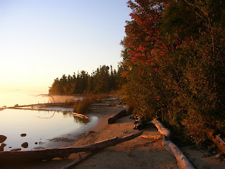
 After I got up I drove across the road to Snug Harbor. The sun was just coming up over the lake and cast a warm glow along the shoreline. I really like the way this picture turned out. One of these days I'm going to walk along the shoreline for a bit.
 I pulled off the road when I saw the sun just starting to hit these trees.
 The same subject with a horizontal composition.
 The leaves against the sky.
 A short trail led back through the trees to an open lot and a trailer. The sun was lighting the trees on the far side of the clearing.
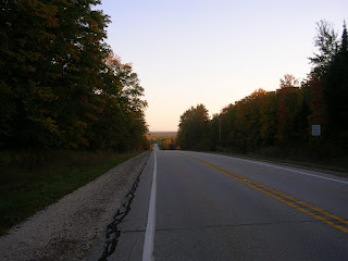
 At the top of a hill looking north along M-123
 I shot a picture from this area in 2001 and it is interesting to see how things have changed. I'll try to post a comparison shot later.
 The Tahquamenon River from the campground.
 Driving back into the campground, I noticed yellow caution tape and orange cones at the entrance to some of the campsites. This tree had begun to topple over in the strong winds the night before. It had come to rest leaning against the center of three closely bunched trees.
 The road out of the campground from near my campsite.
 My campsite. The sites in this part of the campground are pretty big and aren't nearly as close to one another as they are in the modern side. I'd broken camp by this time. The temperatures were near freezing and although my sleeping bag was keeping me warm, the fact that I'd put a liner in it meant that I couldn't move. The car proved to be much more comfortable.
  Looking upriver from the campground.
 A shot through the trees.
 The Upper Falls from an overlook.
 Along M-123 there are a number of small lakes.
 Another of the lakes along M-123.
 The Tahquamenon River from the campground at the Lower Falls. This part of the river is below all the falls.
 The North Country Trail runs through the campground and along the Tahquamenon River. Here, it rises steeply after crossing a small tributary of the river.
 Red leaves on the North Country Trail.
 A view of the Lower Falls to the left of the island from shore.
 To reach the island, you take a rowboat to it. You pull up onto the platform and take the short trail around the island.
 A small cataract.
 A view upriver from the head of the island.
 Another section of falls.
 Another small section of falls.
 From the island looking towards the base of the falls.
 Still another view of the waterfalls.
 Looking at the falls from the boat on the return trip.